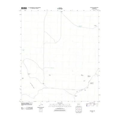
2010 Map of Gage SW
USGS Topo · Published 2010About this map
The Cedar Mountain Range and Klondike Hills dominate this arid landscape in southwestern New Mexico. This region is defined by its water management infrastructure, essential for ranching in the high desert. Scattered across the terrain are several vital water sources and landmarks, including the Tod Hunter Reservoir and the Home Ranch. The landscape is etched with ephemeral watercourses such as Cedar Grove Draw, which are managed through structures like the Palomas Draw Retention Dam Number 8. Windmills are a frequent and significant feature of this map, serving as navigational markers and evidence of local industry. These include Hatcher Windmill, Turkey Knob Windmill, and Cedar Grove Windmill. The presence of these named wells and tanks like Rocky Tank illustrates the carefully maintained network required to sustain life and livestock in this remote part of Grant County.
Find a feature on this map
19 named features on this map. Tap any name to fly to it.
Don’t see what you’re looking for? This feature index may not catch every label — zoom into the map to look around manually.
Map Details
Editions of this 2010 Gage SW Map
This is the sole edition of this map. No revisions or reprints were ever made.
Other maps of this area

1918 · Hachita
USGS Topo · 1:62,500

1918 · Victorio
USGS Topo · 1:62,500

1954 · Silver City
USGS Topo · 1:250,000

1955 · Douglas
USGS Topo · 1:250,000

1958 · Silver City
USGS Topo · 1:250,000

1959 · Douglas
USGS Topo · 1:250,000

1961 · Douglas
USGS Topo · 1:250,000

1962 · Silver City
USGS Topo · 1:250,000

1963 · Gage SW
USGS Topo · 1:24,000

1963 · Gage NW
USGS Topo · 1:24,000