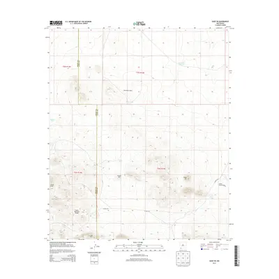
2013 Map of Gage SW
USGS Topo · Published 2013About this map
The Cedar Mountain Range dominates the southern landscape of this high-desert region on the border of Grant and Luna counties. This terrain is defined by its arid drainage patterns and water management features essential for ranching and survival in the Chihuahuan Desert. Significant relief is provided by prominent landmarks such as Sheep Mtn, Deer Mtn, and Turkey Knob, while the northern section is characterized by the broad Seventysix Draw. The presence of several artificial water catchments, including Tod Hunter Reservoir, Sleeper Tank, and Murray Tank, indicates a landscape managed for livestock or wildlife support. Access through this sparsely populated territory is maintained via Co Road C019, which crosses the southern plains beneath the hills. The map captures the intersection of several townships and ranges, providing a precise spatial record of this remote southwestern New Mexico environment.
Find a feature on this map
17 named features on this map. Tap any name to fly to it.
Don’t see what you’re looking for? This feature index may not catch every label — zoom into the map to look around manually.
Map Details
Editions of this 2013 Gage SW Map
This is the sole edition of this map. No revisions or reprints were ever made.
Other maps of this area

1918 · Hachita
USGS Topo · 1:62,500

1918 · Victorio
USGS Topo · 1:62,500

1954 · Silver City
USGS Topo · 1:250,000

1955 · Douglas
USGS Topo · 1:250,000

1958 · Silver City
USGS Topo · 1:250,000

1959 · Douglas
USGS Topo · 1:250,000

1961 · Douglas
USGS Topo · 1:250,000

1962 · Silver City
USGS Topo · 1:250,000

1963 · Gage SW
USGS Topo · 1:24,000

1963 · Gage NW
USGS Topo · 1:24,000