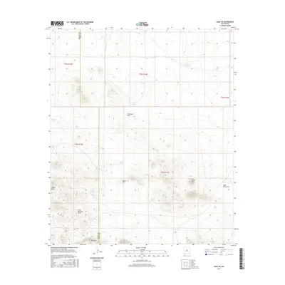
2017 Map of Gage SW
USGS Topo · Published 2017About this map
The Cedar Mountain Range dominates the southern landscape of this high-desert quadrant, where the Grant Co Luna Co boundary line bisects the arid terrain. The map captures a complex system of drainage and water management essential for ranching in this corner of New Mexico. Named features like Seventysix Draw and Cedar Grove Draw snake through the topography, while isolated summits such as Sheep Mtn, Turkey Knob, and Deer Mtn serve as prominent landmarks. Ranching infrastructure is evidenced by scattered water catchments including Tod Hunter Reservoir, Sleeper Tank, and Murray Tank. This 2017 survey provides a high-resolution view of the local topography, showing the intricate contouring of Round Hill and the surrounding basins where seasonal runoff is carefully diverted and collected.
Find a feature on this map
17 named features on this map. Tap any name to fly to it.
Don’t see what you’re looking for? This feature index may not catch every label — zoom into the map to look around manually.
Map Details
Editions of this 2017 Gage SW Map
This is the sole edition of this map. No revisions or reprints were ever made.
Other maps of this area

1918 · Hachita
USGS Topo · 1:62,500

1918 · Victorio
USGS Topo · 1:62,500

1954 · Silver City
USGS Topo · 1:250,000

1955 · Douglas
USGS Topo · 1:250,000

1958 · Silver City
USGS Topo · 1:250,000

1959 · Douglas
USGS Topo · 1:250,000

1961 · Douglas
USGS Topo · 1:250,000

1962 · Silver City
USGS Topo · 1:250,000

1963 · Gage SW
USGS Topo · 1:24,000

1963 · Gage NW
USGS Topo · 1:24,000