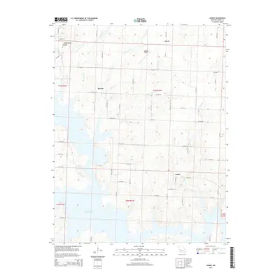
2015 Map of Gaines
USGS Topo · Published 2015About this map
Harry S Truman Reservoir dominates the western and southern reaches of this Henry County landscape, where the rising waters of the Tebo and South Grand arms have permanently altered the local terrain. On the higher ground to the northwest, the city of Clinton expands toward the lake, anchored by the long-established Englewood Cemetery and the Clinton Memorial Airport. The map detail captures a transition from urban grids to a structured rural network of section roads like SE 200th Rd and SE Highway AA.
Find a feature on this map
52 named features on this map. Tap any name to fly to it.
Don’t see what you’re looking for? This feature index may not catch every label — zoom into the map to look around manually.
Map Details
Editions of this 2015 Gaines Map
This is the sole edition of this map. No revisions or reprints were ever made.
Other maps of this area

1887 · Clinton
USGS Topo · 1:125,000

1894 · Clinton
USGS Topo · 1:125,000

1941 · Valhalla
USGS Topo · 1:24,000

1941 · Lowry City
USGS Topo · 1:24,000

1945 · Lowry City
USGS Topo · 1:24,000
1945 · Valhalla
USGS Topo · 1:24,000

1947 · Jefferson City
USGS Topo · 1:250,000

1953 · Gaines
USGS Topo · 1:24,000
1953 · Calhoun East
USGS Topo · 1:24,000

1953 · Clinton South
USGS Topo · 1:24,000