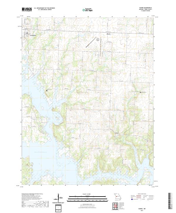
2021 Map of Gaines
USGS Topo · Published 2021About this map
Harry S Truman Reservoir dominates the western and southern landscape of this Henry County region, where the winding inlets of Sparrow Foot Creek, Dumpling Creek, and Pretty Bob Creek meet the rising waters. The eastern edge of Clinton occupies the northwest corner, serving as a gateway to rural communities like Alberta and Gaines. This map illustrates the transition from urban outskirts and the Clinton Regional Airport to the agricultural reaches defined by a rigid grid of country roads, including E Division Road and SE 600th Road. Genealogists will find several significant burial sites preserved among the fields and shoreline, specifically Englewood Cemetery, Bethlehem Cemetery, and Good Hope Cemetery, which provide vital touchpoints for tracing family history in the area.
Find a feature on this map
52 named features on this map. Tap any name to fly to it.
Don’t see what you’re looking for? This feature index may not catch every label — zoom into the map to look around manually.
Map Details
Editions of this 2021 Gaines Map
This is the sole edition of this map. No revisions or reprints were ever made.
Other maps of this area

1887 · Clinton
USGS Topo · 1:125,000

1894 · Clinton
USGS Topo · 1:125,000

1941 · Valhalla
USGS Topo · 1:24,000

1941 · Lowry City
USGS Topo · 1:24,000

1945 · Lowry City
USGS Topo · 1:24,000
1945 · Valhalla
USGS Topo · 1:24,000

1947 · Jefferson City
USGS Topo · 1:250,000

1953 · Gaines
USGS Topo · 1:24,000
1953 · Calhoun East
USGS Topo · 1:24,000

1953 · Clinton South
USGS Topo · 1:24,000