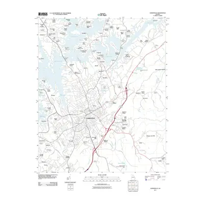
2011 Map of Gainesville
USGS Topo · Published 2011About this map
Gainesville serves as the focal point of this North Georgia survey, where the town's urban footprint meets the sprawling fingers of Lake Sidney Lanier. The map illustrates a landscape shaped by mid-century water management and infrastructure, evidenced by the numerous access points and bridges like Bells Mill Bridge and Clark Bridge that navigate the inundated valleys. Education and industry are anchored at Brenau University and the Gainesville Post Office, while the city's growth is reflected in its surrounding residential developments such as Northlake and New Holland.
Find a feature on this map
153 named features on this map. Tap any name to fly to it.
Don’t see what you’re looking for? This feature index may not catch every label — zoom into the map to look around manually.
Map Details
Editions of this 2011 Gainesville Map
This is the sole edition of this map. No revisions or reprints were ever made.
Other maps of this area

1891 · Gainesville
USGS Topo · 1:125,000

1954 · Greenville
USGS Topo · 1:250,000

1958 · Greenville
USGS Topo · 1:250,000

1964 · Murrayville
USGS Topo · 1:24,000

1964 · Chestnut Mountain
USGS Topo · 1:24,000

1964 · Lula
USGS Topo · 1:24,000

1964 · Gainesville
USGS Topo · 1:24,000
1964 · Chestatee
USGS Topo · 1:24,000

1964 · Pendergrass
USGS Topo · 1:24,000
1964 · Flowery Branch
USGS Topo · 1:24,000