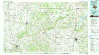
1991 Map of Gainesville
USGS Topo · Published 1991About this map
The Red River snakes through a complex borderland of northern Texas and southern Oklahoma, defining a landscape shaped by both water and petroleum. This 1991 compilation shows the intricate bends of the river, including Sivells Bend and Illinois Bend, which have long dictated the placement of cross-border settlements like Spanish Fort and Thackerville. The regional economy is clearly marked by extensive energy development, with the Greenbrier Oil Field and Hildreth Oil Field punctuating the plains between major hubs like Gainesville and Bowie.
Find a feature on this map
127 named features on this map. Tap any name to fly to it.
Don’t see what you’re looking for? This feature index may not catch every label — zoom into the map to look around manually.
Map Details
Editions of this 1991 Gainesville Map
This is the sole edition of this map. No revisions or reprints were ever made.
Other maps of this area

1901 · Addington
USGS Topo · 1:125,000

1901 · Tishomingo
USGS Topo · 1:125,000

1901 · Ardmore
USGS Topo · 1:125,000

1901 · Denison
USGS Topo · 1:125,000

1902 · Gainesville
USGS Topo · 1:125,000

1905 · Montague
USGS Topo · 1:125,000

1918 · Ardmore
USGS Topo · 1:125,000

1943 · Gainesville
USGS Topo · 1:125,000

1954 · Sherman
USGS Topo · 1:250,000

1954 · Wichita Falls
USGS Topo · 1:250,000