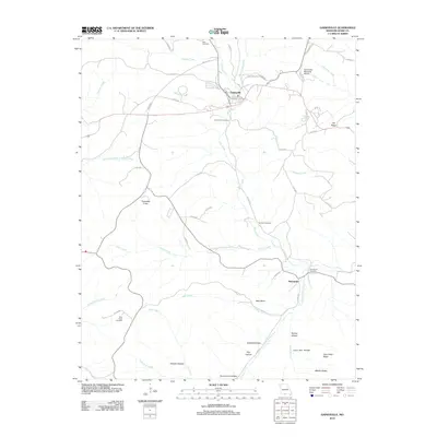
2012 Map of Gainesville
USGS Topo · Published 2012About this map
Gainesville, the county seat of Ozark County, sits at the intersection of a complex drainage system where Lick Creek, Harrison Creek, and Becky Cobb Creek converge. The 2012 landscape reflects a blend of local government infrastructure and rural Ozark homesteads, marked by scattered burial grounds including Gainesville Cemetery, Sims Cemetery, and Sanders Cemetery. Further south, the settlement of Mammoth is situated near Mammoth Cemetery and the waters of Possum Walk Creek. The topography is defined by the sharp transition between creek bottoms and high points like Timbered Knob, Lily Ridge, and Cane Patch Ridge. This survey details the modern road network, from named town streets like White Oak St and 1st St to the winding county routes that follow the hollows, such as Orchard Hollow and Coon Den Hollow.
Find a feature on this map
57 named features on this map. Tap any name to fly to it.
Don’t see what you’re looking for? This feature index may not catch every label — zoom into the map to look around manually.
Map Details
Editions of this 2012 Gainesville Map
This is the sole edition of this map. No revisions or reprints were ever made.
Other maps of this area

1890 · Mountain Home
USGS Topo · 1:125,000

1891 · Mountain Home
USGS Topo · 1:125,000

1893 · Yellville
USGS Topo · 1:125,000

1894 · Mountain Home
USGS Topo · 1:125,000

1903 · Yellville
USGS Topo · 1:125,000

1905 · Yellville
USGS Topo · 1:125,000

1929 · Yellville
USGS Topo · 1:125,000

1934 · Gainesville
USGS Topo · 1:48,000

1936 · Thornfield
USGS Topo · 1:48,000

1940 · Gainesville
USGS Topo · 1:62,500