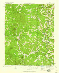
1934 Map of Gainesville
USGS Topo · Published 1958About this map
Gainesville serves as the central hub for this portion of the Ozarks during the early 1930s, a landscape defined by its complex river systems and high ridges. The confluence of Bryant Creek and the North Fork River near Tecumseh highlights a time before major reservoir projects altered these waterways. The map reveals a dense network of rural infrastructure, from one-room schoolhouses like Needmore Sch and Lilly Ridge Sch to small country churches such as Evening Shade and Smith Chapel. Transportation relied on local landmarks like White Ferry and established routes like the Mailroute, while the rugged topography is documented through numerous named peaks including Ludecker Bald and Timber Knob. This survey captures the social geography of Ozark County just as modern improvements began to reach these isolated upland communities.
Find a feature on this map
81 named features on this map. Tap any name to fly to it.
Don’t see what you’re looking for? This feature index may not catch every label — zoom into the map to look around manually.
Map Details
Editions of this 1934 Gainesville Map
2 editions found
Other maps of this area

1890 · Mountain Home
USGS Topo · 1:125,000

1891 · Mountain Home
USGS Topo · 1:125,000

1893 · Yellville
USGS Topo · 1:125,000

1894 · Mountain Home
USGS Topo · 1:125,000

1903 · Yellville
USGS Topo · 1:125,000

1905 · Yellville
USGS Topo · 1:125,000

1929 · Yellville
USGS Topo · 1:125,000

1934 · Gainesville
USGS Topo · 1:48,000

1936 · Thornfield
USGS Topo · 1:48,000

1936 · Ava
USGS Topo · 1:48,000