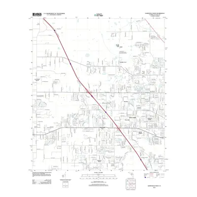
2012 Map of Gainesville West
USGS Topo · Published 2012About this map
Santa Fe Community College serves as a central hub for the western expansion of the area, anchoring a landscape that blends academic infrastructure with established residential pockets. Subdivisions like Chantilly Acres, Rutledge, and Suburban Heights illustrate the suburban character of the region during this era. The map reveals a significant concentration of memorial sites and burial grounds, including Mount Nebo Cem, Morning Star Cem, and West Hills Memorial Gardens, which are critical for local genealogical research.
Find a feature on this map
118 named features on this map. Tap any name to fly to it.
Don’t see what you’re looking for? This feature index may not catch every label — zoom into the map to look around manually.
Map Details
Editions of this 2012 Gainesville West Map
This is the sole edition of this map. No revisions or reprints were ever made.
Other maps of this area

1890 · Arredondo
USGS Topo · 1:62,500

1892 · Arredondo
USGS Topo · 1:62,500

1894 · Arredondo
USGS Topo · 1:62,500

1954 · Gainesville
USGS Topo · 1:250,000

1958 · Gainesville
USGS Topo · 1:250,000

1959 · Gainesville
USGS Topo · 1:250,000

1962 · High Springs
USGS Topo · 1:24,000
1966 · Micanopy
USGS Topo · 1:24,000

1966 · Gainesville West
USGS Topo · 1:24,000

1966 · Arredondo
USGS Topo · 1:24,000