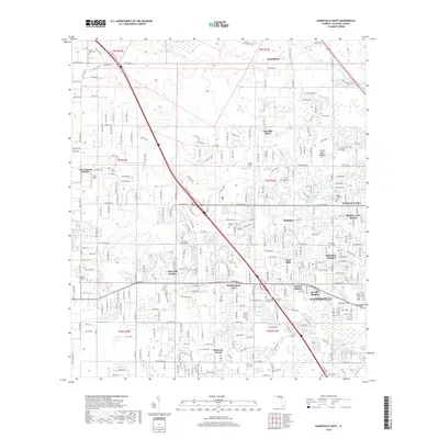
2018 Map of Gainesville West
USGS Topo · Published 2018About this map
Gainesville and its western suburbs are defined by a complex mosaic of modern residential development and significant natural geological features. The notable Devils Mill Hopper geological formation is a focal point of the northern landscape, while large wetlands like Sanchez Prairie and Hogtown Prairie illustrate the local drainage patterns. Academic growth is evident through the sprawling grounds of Santa Fe College and the City College Gainesville Campus, which serve as anchors for the surrounding neighborhoods.
Find a feature on this map
43 named features on this map. Tap any name to fly to it.
Don’t see what you’re looking for? This feature index may not catch every label — zoom into the map to look around manually.
Map Details
Editions of this 2018 Gainesville West Map
This is the sole edition of this map. No revisions or reprints were ever made.
Other maps of this area

1890 · Arredondo
USGS Topo · 1:62,500

1892 · Arredondo
USGS Topo · 1:62,500

1894 · Arredondo
USGS Topo · 1:62,500

1954 · Gainesville
USGS Topo · 1:250,000

1958 · Gainesville
USGS Topo · 1:250,000

1959 · Gainesville
USGS Topo · 1:250,000

1962 · High Springs
USGS Topo · 1:24,000
1966 · Micanopy
USGS Topo · 1:24,000

1966 · Gainesville West
USGS Topo · 1:24,000

1966 · Arredondo
USGS Topo · 1:24,000