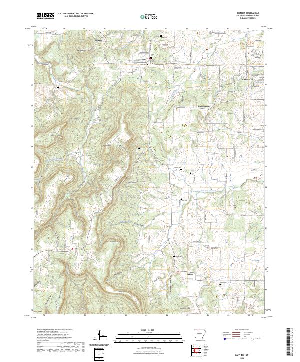
2024 Map of Gaither
USGS Topo · Published 2024About this map
Harrison expands into the eastern portion of this landscape, while the rural communities of Batavia, Capps, and Gaither preserve a more traditional Ozark settlement pattern. The terrain is defined by prominent elevations such as Gaither Mtn and Piney Mtn, with a network of coves and creek valleys providing the geography for local development. Numerous small burial grounds, including Wagley Cem, Coker Cem, and Speer Cem, are scattered across the quadrangle, offering critical data points for family historians tracing early residents. The drainage systems of West Fork Crooked Creek and Denning Creek influence the local road network, which transitions from the residential streets of the county seat to winding rural routes like Pilot Knob Dr S. This juxtaposition highlights the intersection of modern municipal growth and the long-standing agricultural hamlets characteristic of Boone County.
Find a feature on this map
129 named features on this map. Tap any name to fly to it.
Don’t see what you’re looking for? This feature index may not catch every label — zoom into the map to look around manually.
Map Details
Editions of this 2024 Gaither Map
This is the sole edition of this map. No revisions or reprints were ever made.
Other maps of this area

1904 · Harrison
USGS Topo · 1:125,000

1905 · Harrison
USGS Topo · 1:125,000

1945 · Harrison
USGS Topo · 1:250,000

1949 · Harrison
USGS Topo · 1:250,000

1954 · Harrison
USGS Topo · 1:250,000

1958 · Harrison
USGS Topo · 1:250,000

1964 · Harrison
USGS Topo · 1:250,000
1967 · Gaither
USGS Topo · 1:24,000
1967 · Bergman
USGS Topo · 1:24,000
1967 · Jasper
USGS Topo · 1:24,000