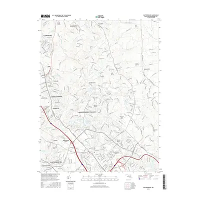
2016 Map of Gaithersburg
USGS Topo · Published 2016About this map
Gaithersburg and Germantown dominate the southern half of this Montgomery County landscape, showing the dense network of suburban development and modern infrastructure in the mid-2010s. The Metropolitan Branch of the railroad bisects the region, connecting historical hubs like Metropolitan Grove and Clopper with the expanding commercial centers. Amidst this growth, older community anchors remain visible, including the Saint Paul Methodist Cem near Laytonsville and the Neelsville Presbyterian Cem in Neelsville.
Find a feature on this map
284 named features on this map. Tap any name to fly to it.
Don’t see what you’re looking for? This feature index may not catch every label — zoom into the map to look around manually.
Map Details
Editions of this 2016 Gaithersburg Map
This is the sole edition of this map. No revisions or reprints were ever made.
Other maps of this area

1893 · Frederick
USGS Topo · 1:125,000

1894 · Frederick
USGS Topo · 1:125,000

1908 · Rockville
USGS Topo · 1:62,500

1908 · Seneca
USGS Topo · 1:62,500

1908 · Ijamsville
USGS Topo · 1:62,500

1909 · Mount Airy
USGS Topo · 1:62,500

1909 · Ijamsville
USGS Topo · 1:62,500

1923 · Rockville
USGS Topo · 1:62,500

1942 · Frederick
USGS Topo · 1:62,500

1944 · Germantown
USGS Topo · 1:31,680