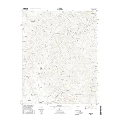
2016 Map of Galen
USGS Topo · Published 2016About this map
Lafayette serves as the focal point of this 2016 survey, situated at the southwestern edge of a landscape defined by small rural settlements and an extensive network of family-named cemeteries. The terrain north and east of the city is characterized by deep hollows like Moss Hollow and Bradley Hollow, where drainage from White Oak Cr and Long Fork has carved a complex series of ridges. This topography influenced the scattered placement of communities such as Galen, Sunrise, and the colorfully named Bugtussle near the Tennessee-Kentucky border. For researchers, the map provides a high density of genealogical sites, including the Frog Pond-Frieridship Cem and the Elias McDonald Cem, often located near crossroads such as Drapers Crossroads and Days Crossroads. The road network, from major routes like Lafayette Rd to local paths like Frog Pond Cemetery Rd, illustrates the persistent settlement patterns of northern Macon County.
Find a feature on this map
129 named features on this map. Tap any name to fly to it.
Don’t see what you’re looking for? This feature index may not catch every label — zoom into the map to look around manually.
Map Details
Editions of this 2016 Galen Map
This is the sole edition of this map. No revisions or reprints were ever made.
Other maps of this area

1931 · Lafayette
USGS Topo · 1:62,500

1931 · Red Boiling Springs
USGS Topo · 1:62,500

1932 · Carthage
USGS Topo · 1:62,500

1954 · Fountain Run
USGS Topo · 1:24,000

1954 · Gamaliel
USGS Topo · 1:24,000

1954 · Holland
USGS Topo · 1:24,000

1956 · Corbin
USGS Topo · 1:250,000

1956 · Nashville
USGS Topo · 1:250,000

1958 · Corbin
USGS Topo · 1:250,000
1958 · Lafayette
USGS Topo · 1:24,000