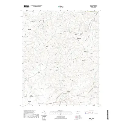
2019 Map of Galen
USGS Topo · Published 2019About this map
Lafayette occupies the southwestern corner of this Tennessee-Kentucky borderland, serving as a hub for a landscape defined by intricate hollows and narrow ridges. The terrain is deeply incised by waterways like Long Fork and White Oak Cr, creating a network of secluded valleys such as Moss Hollow, Ellis Hollow, and Sycamore Valley. This 2019 survey reveals a persistent rural settlement pattern where crossroads like Days Crossroads and Drapers Crossroads anchor the community alongside family-named landmarks and historical burial sites.
Find a feature on this map
127 named features on this map. Tap any name to fly to it.
Don’t see what you’re looking for? This feature index may not catch every label — zoom into the map to look around manually.
Map Details
Editions of this 2019 Galen Map
This is the sole edition of this map. No revisions or reprints were ever made.
Other maps of this area

1931 · Lafayette
USGS Topo · 1:62,500

1931 · Red Boiling Springs
USGS Topo · 1:62,500

1932 · Carthage
USGS Topo · 1:62,500

1954 · Fountain Run
USGS Topo · 1:24,000

1954 · Gamaliel
USGS Topo · 1:24,000

1954 · Holland
USGS Topo · 1:24,000

1956 · Corbin
USGS Topo · 1:250,000

1956 · Nashville
USGS Topo · 1:250,000

1958 · Corbin
USGS Topo · 1:250,000
1958 · Lafayette
USGS Topo · 1:24,000