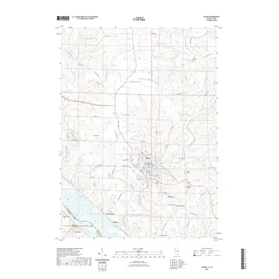
2021 Map of Galena
USGS Topo · Published 2021About this map
Galena is the centerpiece of this terrain, situated at a bend in the Galena River where the street grid climbs steeply from the waterfront along Fulton Street and Summit Street. The town's historical depth is evident in the cluster of sacred sites, including Saint Marys Cemetery and the uniquely named Grace Episcopal Church Resurrection Garden Columbarium. To the south, the landscape shifts toward the vast Mississippi River, where Portage and the Gears Ferry site mark vital connection points for river traffic. The topography is defined by prominent elevations such as Horseshoe Mound and Dygerts Mound, which overlook the winding course of the Sinsinawa River and the backwaters of Kehough Slough. This region near the Illinois-Iowa border shows a clear pattern of land use where high ridges like Pilot Knob separate agricultural valleys from the industrial and transit corridors of the riverfront.
Find a feature on this map
76 named features on this map. Tap any name to fly to it.
Don’t see what you’re looking for? This feature index may not catch every label — zoom into the map to look around manually.
Map Details
Editions of this 2021 Galena Map
This is the sole edition of this map. No revisions or reprints were ever made.
Other maps of this area

1900 · Lancaster
USGS Topo · 1:125,000

1901 · Peosta
USGS Topo · 1:125,000

1902 · Mineral Point
USGS Topo · 1:125,000

1904 · Lancaster
USGS Topo · 1:125,000

1908 · Lancaster
USGS Topo · 1:125,000

1911 · Galena
USGS Topo · 1:62,500

1913 · Galena
USGS Topo · 1:62,500

1935 · East Dubuque
USGS Topo · 1:62,500

1940 · East Dubuque
USGS Topo · 1:62,500

1952 · Cuba City
USGS Topo · 1:24,000