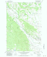
1979 Map of Gales Creek
USGS Topo · Published 1983About this map
The eastern edges of Tillamook State Forest meet the expanding reach of Forest Grove in this late 1970s topographic study. The landscape is defined by the drainage of Gales Creek as it winds southeast toward the Tualatin Valley, past small communities like Hillside and Kansas City. For genealogists, several local burial grounds are documented, including the Forest View Cemetery and the Purdin Cem near Thatcher.
Find a feature on this map
70 named features on this map. Tap any name to fly to it.
Don’t see what you’re looking for? This feature index may not catch every label — zoom into the map to look around manually.
Map Details
Editions of this 1979 Gales Creek Map
3 editions found
Other maps of this area

1941 · Timber
USGS Topo · 1:62,500

1941 · Gales Creek
USGS Topo · 1:62,500

1941 · Yamhill
USGS Topo · 1:62,500

1942 · Yamhill
USGS Topo · 1:62,500

1942 · Fairdale
USGS Topo · 1:62,500

1948 · Vancouver
USGS Topo · 1:250,000

1950 · Vancouver
USGS Topo · 1:250,000

1950 · Vancouver
USGS Topo · 1:250,000

1955 · Timber
USGS Topo · 1:62,500

1955 · Fairdale
USGS Topo · 1:62,500