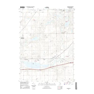
2017 Map of Galesburg
USGS Topo · Published 2017About this map
Galesburg sits at the heart of this landscape, positioned along the banks of the Kalamazoo River and the expansive Morrow Lake. The map reveals a high density of burial sites that speak to the area's long-established communities, including the Galesburg Old Cem, Shafter Cem, and the notable Kalamazoo County Poor Farm Cem. To the north, the terrain transitions into a lake-studded region defined by Gull Lake, Butterfield Lake, and Graham Lake, which have shaped the residential patterns of Yorkville and South Gull Lake. Local history and genealogy are well-represented by smaller settlements like Howlandsburg and Lawndale, while the hydrography of Gull Creek and Comstock Cr illustrates the drainage into the Kalamazoo basin. The layout of roads such as E Michigan Ave and E Main St highlights the primary corridors connecting these riverside and lakeside villages.
Find a feature on this map
84 named features on this map. Tap any name to fly to it.
Don’t see what you’re looking for? This feature index may not catch every label — zoom into the map to look around manually.
Map Details
Editions of this 2017 Galesburg Map
This is the sole edition of this map. No revisions or reprints were ever made.
Other maps of this area

1916 · Kalamazoo
USGS Topo · 1:62,500

1918 · Kalamazoo
USGS Topo · 1:62,500

1918 · Galesburg
USGS Topo · 1:62,500

1918 · Leonidas
USGS Topo · 1:62,500

1922 · Schoolcraft
USGS Topo · 1:62,500

1943 · Kalamazoo
USGS Topo · 1:62,500

1943 · Schoolcraft
USGS Topo · 1:62,500

1944 · Leonidas
USGS Topo · 1:62,500

1944 · Galesburg
USGS Topo · 1:62,500

1947 · Augusta
USGS Topo · 1:24,000