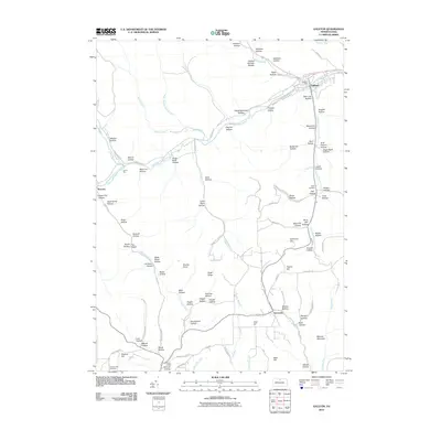
2010 Map of Galeton
USGS Topo · Published 2010About this map
Galeton serves as the focal point of this Potter County landscape, situated where the West Branch Pine Creek meets the main stem of Pine Creek. The local topography is defined by an intricate network of deep-cut drainage basins, many bearing evocative names that hint at the area's historical industries, such as Acid Factory Hollow and Slaughterhouse Hollow. In the southern reaches of the map, the small settlement of Germania sits amidst a collection of ridges including Pigeon Hill and Bibiana Mountain.
Find a feature on this map
109 named features on this map. Tap any name to fly to it.
Don’t see what you’re looking for? This feature index may not catch every label — zoom into the map to look around manually.
Map Details
Editions of this 2010 Galeton Map
This is the sole edition of this map. No revisions or reprints were ever made.
Other maps of this area

1899 · Gaines
USGS Topo · 1:62,500

1900 · Gaines
USGS Topo · 1:62,500

1932 · Genesee
USGS Topo · 1:62,500

1937 · Genesee
USGS Topo · 1:62,500

1947 · Conrad
USGS Topo · 1:62,500

1947 · Galeton
USGS Topo · 1:62,500

1947 · Lee Fire Tower
USGS Topo · 1:24,000

1947 · Short Run
USGS Topo · 1:24,000
1947 · Oleona
USGS Topo · 1:24,000

1947 · Cherry Springs
USGS Topo · 1:24,000