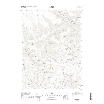
2019 Map of Galeton
USGS Topo · Published 2019About this map
The borough of Galeton serves as the focal point of this northern Pennsylvania landscape, situated at the confluence where the West Branch Pine Creek meets Pine Creek. The surrounding terrain of Potter County is defined by an intricate network of deep hollows and ridges, many bearing names that reflect historical land use and local industry, such as Acid Factory Hollow and Slaughterhouse Hollow. Further south, the settlement of Germania sits along Germania Br, surrounded by high points like Bibiana Mtn and Pigeon Hill. A small burial ground, Byam Cem, is located on a rise overlooking the S Br Pine Cr. The map preserves the complex layout of local waterways like Lyman Run and Little Kettle Cr as they cut through the plateau, providing a detailed record of the region's topography and rural road network as it stood in the late 2010s.
Find a feature on this map
112 named features on this map. Tap any name to fly to it.
Don’t see what you’re looking for? This feature index may not catch every label — zoom into the map to look around manually.
Map Details
Editions of this 2019 Galeton Map
This is the sole edition of this map. No revisions or reprints were ever made.
Other maps of this area

1899 · Gaines
USGS Topo · 1:62,500

1900 · Gaines
USGS Topo · 1:62,500

1932 · Genesee
USGS Topo · 1:62,500

1937 · Genesee
USGS Topo · 1:62,500

1947 · Conrad
USGS Topo · 1:62,500

1947 · Galeton
USGS Topo · 1:62,500

1947 · Lee Fire Tower
USGS Topo · 1:24,000

1947 · Short Run
USGS Topo · 1:24,000
1947 · Oleona
USGS Topo · 1:24,000

1947 · Cherry Springs
USGS Topo · 1:24,000