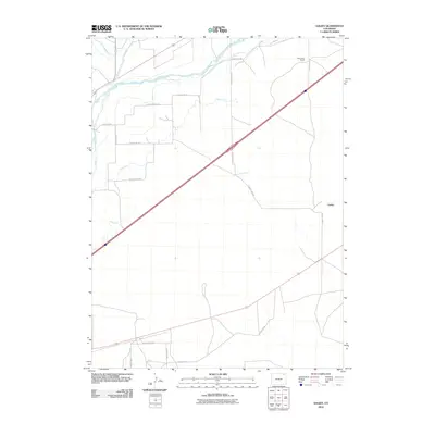
2010 Map of Galien
USGS Topo · Published 2010About this map
The South Platte River cuts through the northern reaches of this Logan County landscape, dictating the development of a complex irrigation network essential for high-plains agriculture. This system of water management is defined by the Iliff Platte Valley Ditch, Lone Tree Ditch, and Farmers Ditch, which channel water away from the river to support the surrounding ranchlands. The small settlement of Galien and the Frank Blair Ranch serve as primary human landmarks in an area otherwise dominated by a rigid grid of section roads and the diagonal path of Interstate 76. Other water-moving features like Bravo Ditch and Cole Ditch illustrate the engineering required to sustain livestock and crops in the arid Colorado climate, while Sterling Lateral Number 1 marks the western edge of the surveyed river valley.
Find a feature on this map
22 named features on this map. Tap any name to fly to it.
Don’t see what you’re looking for? This feature index may not catch every label — zoom into the map to look around manually.
Map Details
Editions of this 2010 Galien Map
This is the sole edition of this map. No revisions or reprints were ever made.
Other maps of this area

1951 · Reiradon Hill
USGS Topo · 1:24,000

1951 · Sterling South
USGS Topo · 1:24,000

1951 · Sterling North
USGS Topo · 1:24,000

1951 · Galien
USGS Topo · 1:24,000

1951 · Iliff
USGS Topo · 1:24,000

1952 · Padroni
USGS Topo · 1:24,000

1953 · Proctor
USGS Topo · 1:24,000

1954 · Sterling
USGS Topo · 1:250,000

1958 · Sterling
USGS Topo · 1:250,000

1962 · Uhler Ranch
USGS Topo · 1:24,000