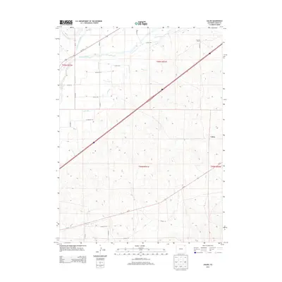
2013 Map of Galien
USGS Topo · Published 2013About this map
The S Platte River defines the northern reaches of this Colorado landscape, flanked by a complex network of agricultural irrigation channels. Water management is the primary driver of development here, with various conduits like the Iliff Platte Valley Ditch, Farmers Ditch, and Bravo Ditch branching away from the river to support the surrounding plains. The settlement of Galien and the Frank Blair Ranch stand as primary landmarks within a grid of rural routes, including Us-138 E and Us-6 E. This 2013 survey illustrates the continued reliance on legacy water systems such as the Sterling Lateral Number 1 and Lone Tree Ditch to sustain the high plains geography of Logan County.
Find a feature on this map
28 named features on this map. Tap any name to fly to it.
Don’t see what you’re looking for? This feature index may not catch every label — zoom into the map to look around manually.
Map Details
Editions of this 2013 Galien Map
This is the sole edition of this map. No revisions or reprints were ever made.
Other maps of this area

1951 · Reiradon Hill
USGS Topo · 1:24,000

1951 · Sterling South
USGS Topo · 1:24,000

1951 · Sterling North
USGS Topo · 1:24,000

1951 · Galien
USGS Topo · 1:24,000

1951 · Iliff
USGS Topo · 1:24,000

1952 · Padroni
USGS Topo · 1:24,000

1953 · Proctor
USGS Topo · 1:24,000

1954 · Sterling
USGS Topo · 1:250,000

1958 · Sterling
USGS Topo · 1:250,000

1962 · Uhler Ranch
USGS Topo · 1:24,000