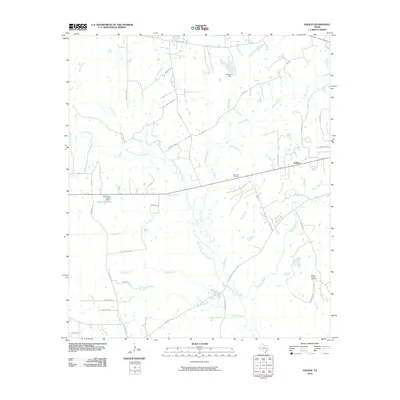
2010 Map of Galilee
USGS Topo · Published 2010About this map
The West Fork San Jacinto River winds through this rural Texas landscape, serving as the central drainage for numerous tributaries like McGary Creek and White Oak Creek. This 2010 survey captures the settlement of Galilee and the surrounding agricultural and timbered lands of Walker County. Historical burial sites such as Ebenezer Cemetery and Martha Chapel Cemetery are preserved on the sheet, providing valuable data for genealogists tracking early area families. Several artificial water features are documented, including Hendricks Lake and the Muecke Dam, reflecting local land management and water usage. The intricate network of local roads, such as Coon Trail Rd and Wire Rd, connects scattered homesteads across a terrain marked by branches and creeks like Robinson Branch and Era Branch.
Find a feature on this map
46 named features on this map. Tap any name to fly to it.
Don’t see what you’re looking for? This feature index may not catch every label — zoom into the map to look around manually.
Map Details
Editions of this 2010 Galilee Map
This is the sole edition of this map. No revisions or reprints were ever made.
Other maps of this area

1954 · Beaumont
USGS Topo · 1:250,000

1957 · Beaumont
USGS Topo · 1:250,000

1959 · Moore Grove
USGS Topo · 1:24,000

1959 · San Jacinto
USGS Topo · 1:24,000

1962 · Pine Prairie
USGS Topo · 1:24,000

1962 · Richards
USGS Topo · 1:24,000

1962 · Galilee
USGS Topo · 1:24,000

1963 · Steep Branch
USGS Topo · 1:24,000

1963 · Crabbs Prairie
USGS Topo · 1:24,000
1963 · Loma
USGS Topo · 1:24,000