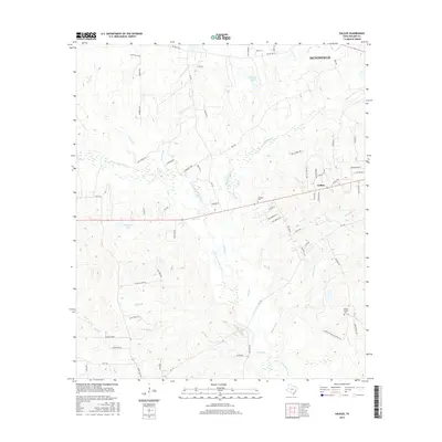
2016 Map of Galilee
USGS Topo · Published 2016About this map
Galilee sits at the heart of this landscape south of Huntsville, where the drainage of the W Fork San Jacinto River carves a complex network of creeks and branches. The settlement pattern is defined by several rural landmarks essential for local history research, including the Ebenezer Cem and Martha Chapel Cem. The terrain is notably water-rich, featuring natural springs such as Mutt Young Spr, Booker Spr, and Roberts Spr, along with named water bodies like Hendricks Lake and Muecke Lake. This 2016 survey documents a transition from established ranch roads like Ward Ranch Rd to newer residential clusters along White Oak Dr and Pine Breeze St. The intricate hydrography, including McGary Cr and White Oak Cr, illustrates the heavy timber and drainage patterns typical of this portion of Walker County.
Find a feature on this map
71 named features on this map. Tap any name to fly to it.
Don’t see what you’re looking for? This feature index may not catch every label — zoom into the map to look around manually.
Map Details
Editions of this 2016 Galilee Map
This is the sole edition of this map. No revisions or reprints were ever made.
Other maps of this area

1954 · Beaumont
USGS Topo · 1:250,000

1957 · Beaumont
USGS Topo · 1:250,000

1959 · Moore Grove
USGS Topo · 1:24,000

1959 · San Jacinto
USGS Topo · 1:24,000

1962 · Pine Prairie
USGS Topo · 1:24,000

1962 · Richards
USGS Topo · 1:24,000

1962 · Galilee
USGS Topo · 1:24,000

1963 · Steep Branch
USGS Topo · 1:24,000

1963 · Crabbs Prairie
USGS Topo · 1:24,000
1963 · Loma
USGS Topo · 1:24,000