
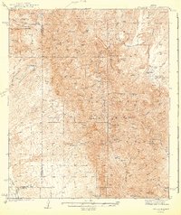
1943 Map of Galiuro Mts
USGS Topo · Published 1943About this map
Crook National Forest dominates this landscape, surveyed in 1938 and published during the second World War. The map details a transition from cattle ranching to hard-rock mining along the sharp ridges of the Galiuro Mountains. Remote outposts like Geronimo Camp, YLE Ranch, and Mercer Ranch are connected by narrow trails and washes, illustrating the isolated nature of the Arizona backcountry in this era.
Find a feature on this map
70 named features on this map. Tap any name to fly to it.
Don’t see what you’re looking for? This feature index may not catch every label — zoom into the map to look around manually.
Map Details
Editions of this 1943 Galiuro Mts Map
2 editions found
Other maps of this area

1904 · Tucson
USGS Topo · 1:125,000

1905 · Tucson
USGS Topo · 1:125,000

1911 · Winkelman
USGS Topo · 1:125,000

1913 · Winkelman
USGS Topo · 1:125,000

1938 · Galiuro Mts
USGS Topo · 1:48,000

1938 · Klondyke
USGS Topo · 1:48,000

1940 · Sierra Bonita Ranch
USGS Topo · 1:62,500

1942 · Sierra Bonita Ranch
USGS Topo · 1:62,500

1943 · Klondyke
USGS Topo · 1:62,500

1943 · Sierra Bonita Ranch
USGS Topo · 1:62,500