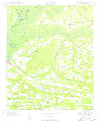
1950 Map of Galivants Ferry
USGS Topo · Published 1950About this map
Little Pee Dee River defines the western edge of this territory, where a complex network of oxbows and landings like Cartwheel Landing and Polecat Landing supported the river-based economy of the mid-century. Further inland, the landscape is dominated by the vast drainage systems of Lake Swamp, Loosing Swamp, and Joiner Swamp, which weave through the agricultural and timber lands between Ketchuptown and Aynor.
Find a feature on this map
73 named features on this map. Tap any name to fly to it.
Don’t see what you’re looking for? This feature index may not catch every label — zoom into the map to look around manually.
Map Details
Editions of this 1950 Galivants Ferry Map
3 editions found

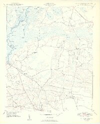
Other maps of this area

1943 · Adrian
USGS Topo · 1:24,000

1943 · Horry
USGS Topo · 1:24,000

1944 · Adrian
USGS Topo · 1:31,680

1946 · Johnsonville
USGS Topo · 1:62,500

1946 · Mullins
USGS Topo · 1:24,000

1947 · Centenary
USGS Topo · 1:24,000

1947 · Mullins
USGS Topo · 1:24,000

1948 · Galivants Ferry
USGS Topo · 1:24,000

1948 · Nichols
USGS Topo · 1:24,000

1948 · Bayboro
USGS Topo · 1:24,000