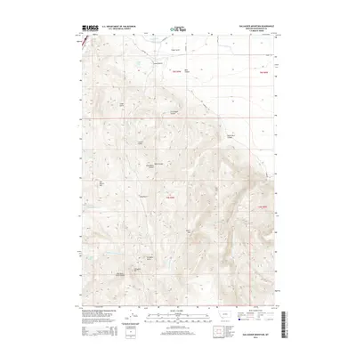
2014 Map of Gallagher Mountain
USGS Topo · Published 2014About this map
Gallagher Mountain and the adjacent Gallagher Butte dominate the high terrain of Beaverhead County in this 2014 survey. The landscape is defined by its sophisticated water management and drainage systems, where the E Bench Canal and Canyon Ditch move water through the northern flats near Lovells Lake. This high-country geography shows a complex network of canyons and gulches, including Small Horn Canyon, Mass Canyon, and Little Basin Canyon, which channel seasonal runoff toward Sheep Creek and the various forks of Gallagher Creek. The presence of several named peaks like Retort Mountain and Jim Brown Mountain suggests a landscape historically utilized for livestock grazing and irrigation, where high-altitude ridges give way to developed agricultural infrastructure at the base of the mountains.
Find a feature on this map
29 named features on this map. Tap any name to fly to it.
Don’t see what you’re looking for? This feature index may not catch every label — zoom into the map to look around manually.
Map Details
Editions of this 2014 Gallagher Mountain Map
This is the sole edition of this map. No revisions or reprints were ever made.
Other maps of this area

1893 · Dillon
USGS Topo · 1:250,000

1952 · Burns Mountain
USGS Topo · 1:24,000

1952 · Dalys
USGS Topo · 1:24,000

1952 · Gallagher Mountain
USGS Topo · 1:24,000

1955 · Dubois
USGS Topo · 1:250,000

1955 · Dillon
USGS Topo · 1:250,000

1957 · Dillon
USGS Topo · 1:250,000

1958 · Dubois
USGS Topo · 1:250,000

1958 · Dillon
USGS Topo · 1:250,000

1961 · Ashbough Canyon
USGS Topo · 1:24,000