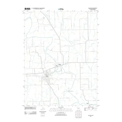
2012 Map of Gallatin
USGS Topo · Published 2012About this map
Gallatin serves as the focal point of this Northwest Missouri landscape, where the street grid of the county seat meets the winding course of the Grand River. The river's influence is evident in the numerous tributaries that drain the surrounding agricultural land, including Big Muddy Creek, Lost Creek, and Cottonwood Creek. To the north, the Everly Cemetery provides a point of genealogical interest near the junction of Big Muddy Creek and local routes like July Ave.
Find a feature on this map
63 named features on this map. Tap any name to fly to it.
Don’t see what you’re looking for? This feature index may not catch every label — zoom into the map to look around manually.
Map Details
Editions of this 2012 Gallatin Map
This is the sole edition of this map. No revisions or reprints were ever made.
Other maps of this area

1922 · Gallatin
USGS Topo · 1:62,500

1924 · Winston
USGS Topo · 1:62,500

1925 · Pattonsburg
USGS Topo · 1:62,500

1925 · Gilman
USGS Topo · 1:62,500

1944 · Pattonsburg
USGS Topo · 1:62,500

1946 · Gilman
USGS Topo · 1:48,000

1946 · Pattonsburg
USGS Topo · 1:48,000

1948 · Gilman
USGS Topo · 1:62,500

1948 · Pattonsburg
USGS Topo · 1:62,500

1950 · Kansas City
USGS Topo · 1:250,000