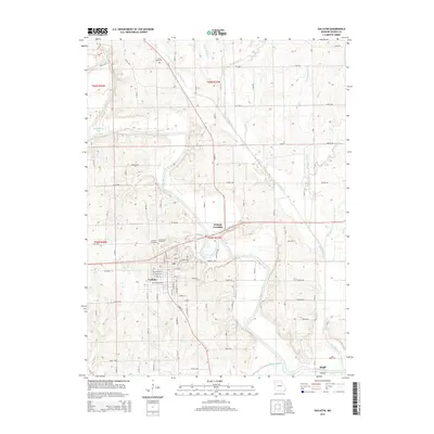
2015 Map of Gallatin
USGS Topo · Published 2015About this map
Gallatin serves as the central hub of this Missouri landscape, situated near the winding course of the Grand River. The town's grid is well-defined by a network of residential and commercial streets, including W Grand St and E Grand St. A short distance north of the primary settlement, the landscape transitions into agricultural terrain marked by family and community landmarks such as Hillcrest Cemetery and Greenwood Cemetery.
Find a feature on this map
48 named features on this map. Tap any name to fly to it.
Don’t see what you’re looking for? This feature index may not catch every label — zoom into the map to look around manually.
Map Details
Editions of this 2015 Gallatin Map
This is the sole edition of this map. No revisions or reprints were ever made.
Other maps of this area

1922 · Gallatin
USGS Topo · 1:62,500

1924 · Winston
USGS Topo · 1:62,500

1925 · Pattonsburg
USGS Topo · 1:62,500

1925 · Gilman
USGS Topo · 1:62,500

1944 · Pattonsburg
USGS Topo · 1:62,500

1946 · Gilman
USGS Topo · 1:48,000

1946 · Pattonsburg
USGS Topo · 1:48,000

1948 · Gilman
USGS Topo · 1:62,500

1948 · Pattonsburg
USGS Topo · 1:62,500

1950 · Kansas City
USGS Topo · 1:250,000