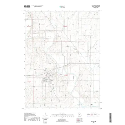
2017 Map of Gallatin
USGS Topo · Published 2017About this map
Gallatin serves as the primary hub of this north-central Missouri landscape, situated near a prominent southern bend of the Grand River. The terrain is deeply etched by a complex drainage network, where numerous tributaries such as Big Muddy Cr, Little Muddy Cr, and Lost Creek converge toward the main river valley. This hydrology significantly influenced the regional road grid, with many routes following the ridgelines between these creeks. Local history researchers will find several notable burial sites surrounding the town, including Everly Cem to the north and the adjacent Greenwood Cem and Hillcrest Cem on the western edge of the settlement. To the southeast, the small community of Magill sits near the confluence of Honey Creek and the Grand River, illustrating the historic pattern of small riverbank settlements in Daviess County.
Find a feature on this map
83 named features on this map. Tap any name to fly to it.
Don’t see what you’re looking for? This feature index may not catch every label — zoom into the map to look around manually.
Map Details
Editions of this 2017 Gallatin Map
This is the sole edition of this map. No revisions or reprints were ever made.
Other maps of this area

1922 · Gallatin
USGS Topo · 1:62,500

1924 · Winston
USGS Topo · 1:62,500

1925 · Pattonsburg
USGS Topo · 1:62,500

1925 · Gilman
USGS Topo · 1:62,500

1944 · Pattonsburg
USGS Topo · 1:62,500

1946 · Gilman
USGS Topo · 1:48,000

1946 · Pattonsburg
USGS Topo · 1:48,000

1948 · Gilman
USGS Topo · 1:62,500

1948 · Pattonsburg
USGS Topo · 1:62,500

1950 · Kansas City
USGS Topo · 1:250,000