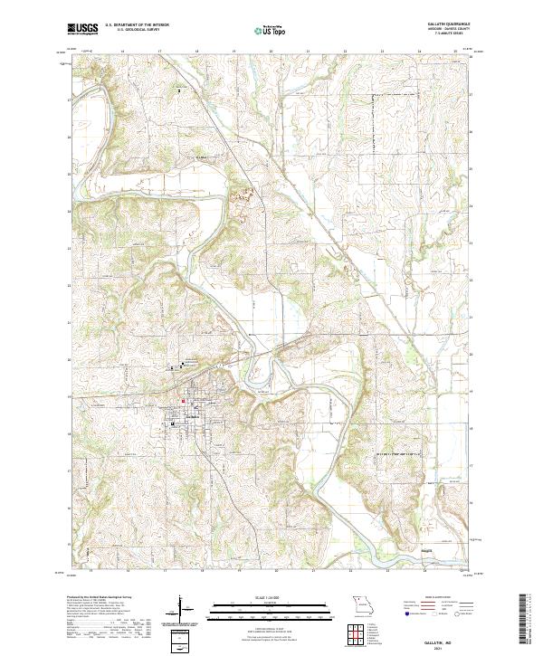
2021 Map of Gallatin
USGS Topo · Published 2021About this map
The Daviess County Courthouse serves as the focal point for Gallatin, a settlement defined by its position near the meandering Grand River. This landscape is deeply etched by a network of waterways including Big Muddy Cr, Little Muddy Cr, and Pilot Grove Cr, which dictate the local topography and the placement of rural cemeteries like Everly Cem and Brown Cem. The river's winding course creates a complex series of bluffs and bottomlands, particularly visible near the smaller settlement of Magill in the southeast.
Find a feature on this map
80 named features on this map. Tap any name to fly to it.
Don’t see what you’re looking for? This feature index may not catch every label — zoom into the map to look around manually.
Map Details
Editions of this 2021 Gallatin Map
This is the sole edition of this map. No revisions or reprints were ever made.
Other maps of this area

1922 · Gallatin
USGS Topo · 1:62,500

1924 · Winston
USGS Topo · 1:62,500

1925 · Pattonsburg
USGS Topo · 1:62,500

1925 · Gilman
USGS Topo · 1:62,500

1944 · Pattonsburg
USGS Topo · 1:62,500

1946 · Gilman
USGS Topo · 1:48,000

1946 · Pattonsburg
USGS Topo · 1:48,000

1948 · Gilman
USGS Topo · 1:62,500

1948 · Pattonsburg
USGS Topo · 1:62,500

1950 · Kansas City
USGS Topo · 1:250,000