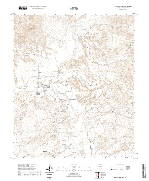
2021 Map of Galleta Flat East
USGS Topo · Published 2021About this map
Pomerene and the northern outskirts of Benson anchor this modern topographical study of the San Pedro River corridor. The river flows northward through the San Pedro Valley, flanked by a network of drainage systems including Tres Alamos Wash, Pacheco Wash, and Cadillac Wash. The terrain is defined by the steep rises of the Little Rincon Mountains to the northwest and the winding Cornfield Canyon to the southwest. Land use is a mix of aviation infrastructure at the Benson Municipal Airport and localized irrigation features like Willow Lake near Ash Creek. The intricate residential road network, particularly around Galleta Flat and east of the river, reveals contemporary rural development patterns where modern street names like N Desert Rose Ln and W Running Bird Ln meet established ranching routes such as E Keith Ranch Rd.
Find a feature on this map
62 named features on this map. Tap any name to fly to it.
Don’t see what you’re looking for? This feature index may not catch every label — zoom into the map to look around manually.
Map Details
Editions of this 2021 Galleta Flat East Map
This is the sole edition of this map. No revisions or reprints were ever made.
Other maps of this area

1915 · Benson
USGS Topo · 1:125,000

1922 · St. David
USGS Topo · 1:62,500

1926 · Whetstone
USGS Topo · 1:62,500

1943 · Benson
USGS Topo · 1:125,000

1943 · Dragoon
USGS Topo · 1:62,500

1945 · Happy Valley
USGS Topo · 1:62,500

1956 · Nogales
USGS Topo · 1:250,000

1956 · Tucson
USGS Topo · 1:250,000

1958 · Nogales
USGS Topo · 1:250,000

1958 · Tucson
USGS Topo · 1:250,000