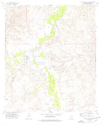
1973 Map of Galleta Flat East
USGS Topo · Published 1976About this map
The San Pedro Valley serves as the primary corridor in this 1970s Arizona landscape, where the perennial San Pedro River winds through a terrain defined by desert flats and intermittent watercourses. Human activity is concentrated along the riverbanks and the nearby slopes of the Little Rincon Mts, with the Singing Wind Ranch and the northern reaches of Pomerene representing the sparse but established settlement pattern of the era. The mapping of Willow Lake and numerous water features like Tres Alamos Wash and Ash Creek highlights the critical importance of water management in this arid environment. Beyond the valley floor, the landscape transitions into the distinct geographic areas of Galleta Flat and Cornfield Flat, where local nomenclature suggests a history of grazing or opportunistic agriculture. A network of jeep trails and scattered landmarks like Stone Tank and various wells underscore the rural, working character of Cochise County during this period.
Find a feature on this map
21 named features on this map. Tap any name to fly to it.
Don’t see what you’re looking for? This feature index may not catch every label — zoom into the map to look around manually.
Map Details
Editions of this 1973 Galleta Flat East Map
This is the sole edition of this map. No revisions or reprints were ever made.
Other maps of this area

1915 · Benson
USGS Topo · 1:125,000

1922 · St. David
USGS Topo · 1:62,500

1926 · Whetstone
USGS Topo · 1:62,500

1943 · Benson
USGS Topo · 1:125,000

1943 · Dragoon
USGS Topo · 1:62,500

1945 · Happy Valley
USGS Topo · 1:62,500

1956 · Nogales
USGS Topo · 1:250,000

1956 · Tucson
USGS Topo · 1:250,000

1958 · Nogales
USGS Topo · 1:250,000

1958 · Tucson
USGS Topo · 1:250,000