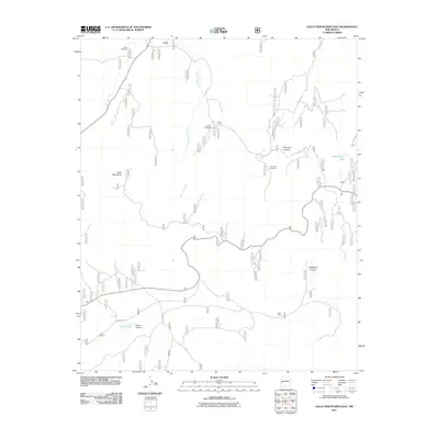
2011 Map of Gallo Mountains East
USGS Topo · Published 2011About this map
Gallo Mountains dominate this high-altitude landscape in New Mexico, where deep drainages like Telephone Canyon and Gallita Canyon carve through the high country. The terrain is defined by its water sources, both natural and man-made, which sustain life in this arid region. From the flowing Agua Fria Creek and Porcupine Spring to the isolated waters of White Rock Lake and Gallo Lake, these features are critical landmarks. Scattered throughout the territory are functional markers of ranching and land management, including the Davis Windmill, Sawmill Windmill, and First Windmill. The presence of the Armijo Campground and several Forest Service routes, such as FS RD 13a and FS RD 854, indicates the intersection of public recreation and forestry work. Near the southern edge of the survey, Bull Camp remains a notable point of interest, reflecting the region's enduring history of backcountry habitation.
Find a feature on this map
18 named features on this map. Tap any name to fly to it.
Don’t see what you’re looking for? This feature index may not catch every label — zoom into the map to look around manually.
Map Details
Editions of this 2011 Gallo Mountains East Map
This is the sole edition of this map. No revisions or reprints were ever made.
Other maps of this area

1915 · Reserve
USGS Topo · 1:125,000

1918 · Pelona
USGS Topo · 1:125,000

1918 · Reserve
USGS Topo · 1:125,000

1954 · Clifton
USGS Topo · 1:250,000

1954 · Saint Johns
USGS Topo · 1:250,000

1957 · Clifton
USGS Topo · 1:250,000

1957 · Saint Johns
USGS Topo · 1:250,000

1958 · Clifton
USGS Topo · 1:250,000

1958 · Saint Johns
USGS Topo · 1:250,000

1962 · Clifton
USGS Topo · 1:250,000