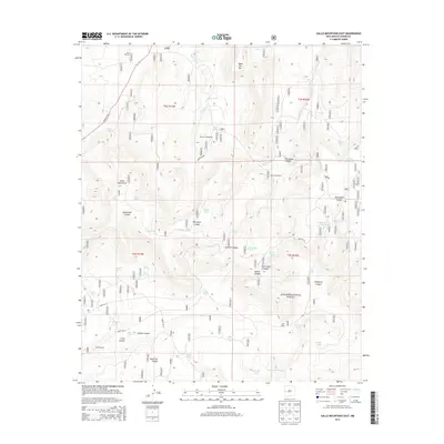
2013 Map of Gallo Mountains East
USGS Topo · Published 2013About this map
The Gallo Mountains define this high-elevation landscape within the Apache National Forest, where a network of canyons and water-management features illustrates the region's ranching and forestry history. Water sources are critical here, evidenced by numerous named improvements such as Davis Windmill, Armijo Tank, and Preference Tank. The presence of the Armijo Campground near Armijo Spring suggests a long-standing point of human activity along the Agua Fria Cr. The geography is deeply dissected by drainage systems like Gallita Canyon and Telephone Canyon, while higher points like Agua Fria Mtn offer significant vertical relief. Infrastructure is limited to remote routes like State Hwy 32 and various forest roads, reflecting the isolated character of this part of Catron County.
Find a feature on this map
57 named features on this map. Tap any name to fly to it.
Don’t see what you’re looking for? This feature index may not catch every label — zoom into the map to look around manually.
Map Details
Editions of this 2013 Gallo Mountains East Map
This is the sole edition of this map. No revisions or reprints were ever made.
Other maps of this area

1915 · Reserve
USGS Topo · 1:125,000

1918 · Pelona
USGS Topo · 1:125,000

1918 · Reserve
USGS Topo · 1:125,000

1954 · Clifton
USGS Topo · 1:250,000

1954 · Saint Johns
USGS Topo · 1:250,000

1957 · Clifton
USGS Topo · 1:250,000

1957 · Saint Johns
USGS Topo · 1:250,000

1958 · Clifton
USGS Topo · 1:250,000

1958 · Saint Johns
USGS Topo · 1:250,000

1962 · Clifton
USGS Topo · 1:250,000