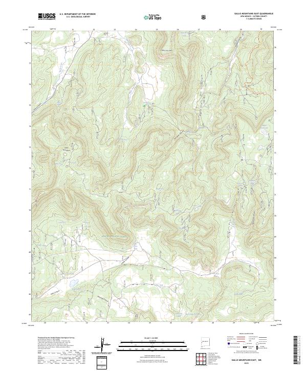
2023 Map of Gallo Mountains East
USGS Topo · Published 2023About this map
Apache National Forest lands dominate this high-altitude terrain in Catron County, characterized by the rugged western slopes of the Gallo Mountains. The landscape is defined by an intricate network of drainage systems and isolated peaks, including Agua Fria Mtn and deep cuts like Bull Camp Canyon and Sawmill Canyon. Water management is central to the area's utility, evidenced by dozens of named tanks and springs scattered across the survey area.
Find a feature on this map
42 named features on this map. Tap any name to fly to it.
Don’t see what you’re looking for? This feature index may not catch every label — zoom into the map to look around manually.
Map Details
Editions of this 2023 Gallo Mountains East Map
This is the sole edition of this map. No revisions or reprints were ever made.
Other maps of this area

1915 · Reserve
USGS Topo · 1:125,000

1918 · Pelona
USGS Topo · 1:125,000

1918 · Reserve
USGS Topo · 1:125,000

1954 · Clifton
USGS Topo · 1:250,000

1954 · Saint Johns
USGS Topo · 1:250,000

1957 · Clifton
USGS Topo · 1:250,000

1957 · Saint Johns
USGS Topo · 1:250,000

1958 · Clifton
USGS Topo · 1:250,000

1958 · Saint Johns
USGS Topo · 1:250,000

1962 · Clifton
USGS Topo · 1:250,000