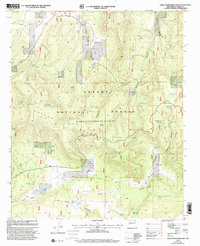
1999 Map of Gallo Mountains East
USGS Topo · Published 2002About this map
The Gallo Mountains define the high country of this region within the Apache National Forest, where a complex network of canyons and water sources supported livestock and land management in the late 20th century. Named canyons like Harris Canyon, Porcupine Canyon, and Telephone Canyon carve through the high ridges, leading toward the broad expanse of Sand Flat in the south. The distribution of infrastructure such as the Davis Windmill, Sawmill Windmill, and numerous tanks like Armijo Tank and Hog Rock Pit Tank reflects a landscape meticulously developed for water access. Natural springs including Willow Spring and Pueblo Spring appear alongside modern modifications like Gallo Lake, illustrating the intersection of natural geography and forest administration.
Find a feature on this map
54 named features on this map. Tap any name to fly to it.
Don’t see what you’re looking for? This feature index may not catch every label — zoom into the map to look around manually.
Map Details
Editions of this 1999 Gallo Mountains East Map
This is the sole edition of this map. No revisions or reprints were ever made.
Other maps of this area

1915 · Reserve
USGS Topo · 1:125,000

1918 · Pelona
USGS Topo · 1:125,000

1918 · Reserve
USGS Topo · 1:125,000

1954 · Clifton
USGS Topo · 1:250,000

1954 · Saint Johns
USGS Topo · 1:250,000

1957 · Clifton
USGS Topo · 1:250,000

1957 · Saint Johns
USGS Topo · 1:250,000

1958 · Clifton
USGS Topo · 1:250,000

1958 · Saint Johns
USGS Topo · 1:250,000

1962 · Clifton
USGS Topo · 1:250,000