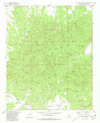
1981 Map of Gallo Mountains West
USGS Topo · Published 1981About this map
Fox Mountain and the high ridges of the Apache National Forest dominate this high-altitude landscape in western New Mexico. The 1981 data reflects a region defined by its water sources and rugged canyons, including Blanco Cañon and Steel Canyon. Evidence of human activity is scattered across the terrain, from the Lookout atop Fox Mountain to the remote Landing Strip on Jewett Mesa. Named family landmarks like Hardcastle and numerous springs such as Steel Tank Spring and Oso Negro Tank highlight the importance of water management for cattle ranching in the Gallo Mountains. The concentration of improvements around Jewett Gap, including a Roadside Park, suggests a critical passage through the mountains during this era.
Find a feature on this map
59 named features on this map. Tap any name to fly to it.
Don’t see what you’re looking for? This feature index may not catch every label — zoom into the map to look around manually.
Map Details
Editions of this 1981 Gallo Mountains West Map
This is the sole edition of this map. No revisions or reprints were ever made.
Other maps of this area

1915 · Reserve
USGS Topo · 1:125,000

1918 · Reserve
USGS Topo · 1:125,000

1954 · Clifton
USGS Topo · 1:250,000

1954 · Saint Johns
USGS Topo · 1:250,000

1955 · Red Hill
USGS Topo · 1:24,000

1957 · Clifton
USGS Topo · 1:250,000

1957 · Saint Johns
USGS Topo · 1:250,000

1958 · Clifton
USGS Topo · 1:250,000

1958 · Saint Johns
USGS Topo · 1:250,000

1962 · Clifton
USGS Topo · 1:250,000