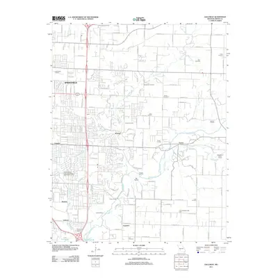
2011 Map of Galloway
USGS Topo · Published 2011About this map
The James River snakes through the eastern edges of Springfield, Missouri, anchoring a landscape where suburban expansion meets rural history. This survey captures a dense network of local landmarks, including the historic Kinser Bridge and a notable concentration of family and community burial grounds such as Westmoreland Cemetery, Bodenhamer Cemetery, and Pursley Cemetery. Small settlements like Mumford, Turners, and Galloway are visible amidst a rapidly growing road grid, while aviation history is represented by the Downtown Airport and the Flying Bar H Ranch Airport to the east. Water management and recreation are central to the area's character, evidenced by Lake Springfield, the Leo Journagan Lake Dam, and the Ford Lake Dam on Pierson Creek. The transition from the urban core of Springfield to the quieter reaches of Big Hollow illustrates the evolving footprint of Greene County at the start of the 2010s.
Find a feature on this map
129 named features on this map. Tap any name to fly to it.
Don’t see what you’re looking for? This feature index may not catch every label — zoom into the map to look around manually.
Map Details
Editions of this 2011 Galloway Map
This is the sole edition of this map. No revisions or reprints were ever made.
Other maps of this area

1884 · Springfield
USGS Topo · 1:125,000

1886 · Springfield
USGS Topo · 1:125,000

1935 · Springfield
USGS Topo · 1:24,000

1937 · Galloway
USGS Topo · 1:24,000

1937 · Ozark
USGS Topo · 1:48,000

1943 · Ozark
USGS Topo · 1:62,500

1945 · Ozark
USGS Topo · 1:62,500

1946 · Bassville
USGS Topo · 1:24,000

1947 · Strafford
USGS Topo · 1:62,500

1948 · Bassville
USGS Topo · 1:24,000