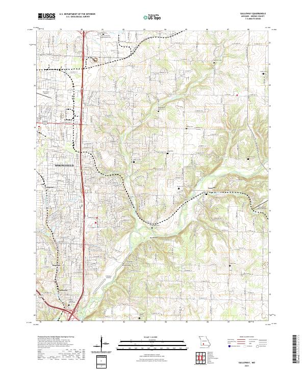
2021 Map of Galloway
USGS Topo · Published 2021About this map
Pierson Creek and the James River define the eastern edge of the Ozarks' most significant urban expansion in this 2021 survey of Greene County. The map documents the interface between the eastern suburbs of Springfield and the rolling bottomlands near Turners. For genealogists, the landscape is punctuated by numerous family-named burial grounds including Danforth Cemetery, Bodenhamer Cemetery, and the Hancock Morton Westmoreland Cemetery. The transit network shows a mix of heavy industrial infrastructure like the BNSF Railway alongside general aviation sites such as Childress Airstrip and the Flying Bar H Ranch Airport. Significant recreational and community spaces like Sequiota Park and Klinger-Cope at Rivermonte illustrate the established nature of the Galloway and Sequiota neighborhoods during the early 21st century.
Find a feature on this map
104 named features on this map. Tap any name to fly to it.
Don’t see what you’re looking for? This feature index may not catch every label — zoom into the map to look around manually.
Map Details
Editions of this 2021 Galloway Map
This is the sole edition of this map. No revisions or reprints were ever made.
Other maps of this area

1884 · Springfield
USGS Topo · 1:125,000

1886 · Springfield
USGS Topo · 1:125,000

1935 · Springfield
USGS Topo · 1:24,000

1937 · Galloway
USGS Topo · 1:24,000

1937 · Ozark
USGS Topo · 1:48,000

1943 · Ozark
USGS Topo · 1:62,500

1945 · Ozark
USGS Topo · 1:62,500

1946 · Bassville
USGS Topo · 1:24,000

1947 · Strafford
USGS Topo · 1:62,500

1948 · Bassville
USGS Topo · 1:24,000