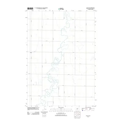
2012 Map of Gallup
USGS Topo · Published 2012About this map
The James River meanders heavily across this section of Tetonka Township, creating a complex series of oxbows and tight bends as it flows through the glacial plains of Spink County. This intricate hydrography dominates the landscape, influencing the placement of the section-line road grid that characterizes the eastern Dakotas. The small settlement of Gallup is situated in the western portion of the map along 387th Ave, serving as a focal point for the surrounding agricultural community. The map illustrates a highly organized rural infrastructure, where routes like Jefferson Dr and 157th St navigate around the river’s erratic path. This survey captures the intersection of natural river morphology and the deliberate, surveyed geometry of the American Midwest, providing a clear record of the area's drainage patterns and land-use divisions.
Find a feature on this map
19 named features on this map. Tap any name to fly to it.
Don’t see what you’re looking for? This feature index may not catch every label — zoom into the map to look around manually.
Map Details
Editions of this 2012 Gallup Map
This is the sole edition of this map. No revisions or reprints were ever made.
Other maps of this area

1895 · Byron
USGS Topo · 1:125,000

1895 · Aberdeen
USGS Topo · 1:125,000

1899 · Northville
USGS Topo · 1:125,000

1899 · Redfield
USGS Topo · 1:125,000

1953 · Brentford
USGS Topo · 1:24,000

1953 · Frankfort
USGS Topo · 1:24,000

1953 · Redfield North
USGS Topo · 1:24,000

1953 · Gallup
USGS Topo · 1:24,000

1953 · Ashton
USGS Topo · 1:24,000

1953 · Huron
USGS Topo · 1:250,000