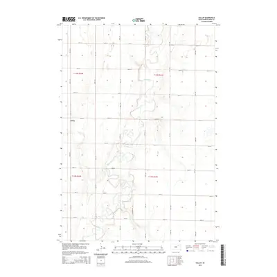
2015 Map of Gallup
USGS Topo · Published 2015About this map
The James River meanders through the heart of Spink County in this 2015 survey, defining the rural character of Tetonka Township. The settlement of Gallup is situated on the western edge of the river valley, marking a focal point for the surrounding agricultural grid. This landscape is partitioned by a meticulous network of gravel roads and section lines, including 387th Ave and 160th St, which facilitate transport across the fertile plains of the Glacial Lake Dakota region. The map captures the subtle topography of the river's floodplain, where small oxbows and drainage patterns interrupt the vast, uniform sections of the Public Land Survey System. Modern infrastructure like Jefferson Dr integrates with established township roads, reflecting the continued importance of the river corridor for local transit and land management in the northern Great Plains.
Find a feature on this map
21 named features on this map. Tap any name to fly to it.
Don’t see what you’re looking for? This feature index may not catch every label — zoom into the map to look around manually.
Map Details
Editions of this 2015 Gallup Map
This is the sole edition of this map. No revisions or reprints were ever made.
Other maps of this area

1895 · Byron
USGS Topo · 1:125,000

1895 · Aberdeen
USGS Topo · 1:125,000

1899 · Northville
USGS Topo · 1:125,000

1899 · Redfield
USGS Topo · 1:125,000

1953 · Brentford
USGS Topo · 1:24,000

1953 · Frankfort
USGS Topo · 1:24,000

1953 · Redfield North
USGS Topo · 1:24,000

1953 · Gallup
USGS Topo · 1:24,000

1953 · Ashton
USGS Topo · 1:24,000

1953 · Huron
USGS Topo · 1:250,000