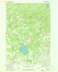
1970 Map of Galway
USGS Topo · Published 1972About this map
Galway and its surrounding hamlets appear here in the early 1970s, illustrating the transition between the agricultural south and the edge of the Adirondack State Park to the north. The landscape is defined by its water bodies, specifically the prominent Galway Lake and the smaller Lake Nancy and Lake Butterfield. The settlement pattern follows a network of historic crossroads, many bearing the names of early resident families such as Wiley Corners, Shaw Corners, and Skinner Corners.
Find a feature on this map
87 named features on this map. Tap any name to fly to it.
Don’t see what you’re looking for? This feature index may not catch every label — zoom into the map to look around manually.
Map Details
Editions of this 1970 Galway Map
This is the sole edition of this map. No revisions or reprints were ever made.
Other maps of this area

1893 · Schenectady
USGS Topo · 1:62,500

1895 · Schenectady
USGS Topo · 1:62,500

1895 · Amsterdam
USGS Topo · 1:62,500

1898 · Schenectady
USGS Topo · 1:62,500

1899 · Broadalbin
USGS Topo · 1:62,500

1902 · Broadalbin
USGS Topo · 1:62,500

1902 · Saratoga
USGS Topo · 1:62,500

1930 · Schenectady
USGS Topo · 1:62,500

1931 · Amsterdam
USGS Topo · 1:62,500

1935 · Middle Grove
USGS Topo · 1:24,000