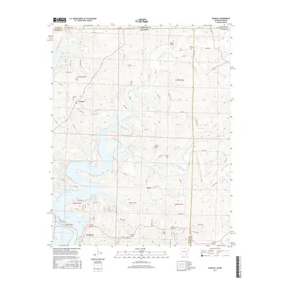
2017 Map of Gamaliel
USGS Topo · Published 2017About this map
Norfork Lake dominates the southwestern portion of this landscape, its winding fingers reaching into Howard Cove and along the shores of Bidwell Point. Near the southern edge of the map, the settlement of Henderson sits along the waterfront, while the community of Gamaliel occupies higher ground to the north, served by its eponymous Gamaliel Cem. The terrain is defined by a dense network of drainage systems, including Bennetts Bayou and Bennetts River, which carve through the Ozark landscape near the border of Missouri and Arkansas. Genealogists will find several small burial sites scattered across the ridges, such as the County Line Cem and Fluty Cem, reflecting the rural settlement patterns of Fulton and Baxter counties. The map also captures several hollows and knobs, including Turkey Knob and Walker Hollow, alongside a complex grid of county roads connecting these remote communities.
Find a feature on this map
89 named features on this map. Tap any name to fly to it.
Don’t see what you’re looking for? This feature index may not catch every label — zoom into the map to look around manually.
Map Details
Editions of this 2017 Gamaliel Map
This is the sole edition of this map. No revisions or reprints were ever made.
Other maps of this area

1890 · Mountain Home
USGS Topo · 1:125,000

1891 · Mountain Home
USGS Topo · 1:125,000

1894 · Mountain Home
USGS Topo · 1:125,000

1934 · Gainesville
USGS Topo · 1:48,000

1940 · Gainesville
USGS Topo · 1:62,500

1944 · Cureall
USGS Topo · 1:62,500

1945 · Harrison
USGS Topo · 1:250,000

1946 · Cureall
USGS Topo · 1:62,500

1949 · Harrison
USGS Topo · 1:250,000

1954 · Harrison
USGS Topo · 1:250,000