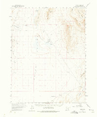
1960 Map of Gandy
USGS Topo · Published 1975About this map
Snake Valley serves as the central focal point of this arid basin, where life clustered around rare water sources like the Bishop Springs Area and Salt Marsh Lake. The settlement of Gandy sits at the edge of the Foote Range, representing a fragile human foothold in the high desert of the eastern Great Basin. Nearby, the designation of Smithville (Site) marks the location of a town that had already faded by the time of the 1959–1960 surveys. The landscape is defined by the stark transition from the floor of the valley to the prominent peaks of the Confusion Range and Chevron Ridge. This mapping detail captures a network of Jeep Trails and unnamed roads, such as Gandy Road, which connected isolated ranches and watering holes like North Knoll Spring and Twin Springs before the modernization of the rural Utah interior.
Find a feature on this map
25 named features on this map. Tap any name to fly to it.
Don’t see what you’re looking for? This feature index may not catch every label — zoom into the map to look around manually.
Map Details
Editions of this 1960 Gandy Map
2 editions found
Other maps of this area

1908 · Fish Springs
USGS Topo · 1:250,000

1910 · Fish Springs
USGS Topo · 1:250,000

1953 · Delta
USGS Topo · 1:250,000

1956 · Ely
USGS Topo · 1:250,000

1958 · Delta
USGS Topo · 1:250,000

1959 · Ely
USGS Topo · 1:250,000

1959 · Cowboy Pass
USGS Topo · 1:62,500

1960 · Granite Mountain
USGS Topo · 1:62,500

1960 · Conger Range
USGS Topo · 1:62,500

1960 · Gandy
USGS Topo · 1:62,500