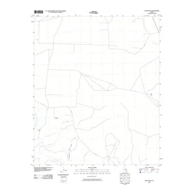
2010 Map of Gant Hills
USGS Topo · Published 2010About this map
Gant Hills and the winding course of the Double Mountain Fork Brazos River dominate this West Texas landscape in Kent County. The map documents a sparse, ranching-oriented settlement pattern defined by isolated landmarks like the Iron Trap Windmill and the collection of buildings at South Camp. This 2010 survey illustrates the remote character of the region, where infrastructure consists primarily of county roads such as Co RD 413 and specialized private routes. The presence of Cottonwood Pens Draw and Maverick Creek indicates a terrain shaped by ephemeral watercourses and livestock management, offering a precise look at the land's utility and the enduring footprint of rural Texas range life before further modern development.
Find a feature on this map
12 named features on this map. Tap any name to fly to it.
Don’t see what you’re looking for? This feature index may not catch every label — zoom into the map to look around manually.
Map Details
Editions of this 2010 Gant Hills Map
This is the sole edition of this map. No revisions or reprints were ever made.
Other maps of this area

1926 · Snyder 1-a
USGS Topo · 1:48,000

1932 · Camp Springs
USGS Topo · 1:62,500

1954 · Lubbock
USGS Topo · 1:250,000

1954 · Big Spring
USGS Topo · 1:250,000

1958 · Big Spring
USGS Topo · 1:250,000
1969 · A B C Creek
USGS Topo · 1:24,000

1969 · Maverick Creek
USGS Topo · 1:24,000
1969 · Hudd
USGS Topo · 1:24,000

1969 · Cooper Mountain
USGS Topo · 1:24,000

1969 · Clairemont East
USGS Topo · 1:24,000