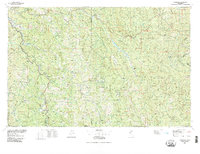
1979 Map of Garberville
USGS Topo · Published 1996About this map
Humboldt Redwoods State Park dominates the western portion of this 1970s landscape, protecting ancient groves along the winding South Fork Eel River. The regional hub of Garberville serves as the primary settlement, situated near Redway and Phillipsville along the Us 101 corridor. Moving east, the terrain becomes increasingly complex as it rises into the Six Rivers National Forest and Trinity National Forest.
Find a feature on this map
73 named features on this map. Tap any name to fly to it.
Don’t see what you’re looking for? This feature index may not catch every label — zoom into the map to look around manually.
Map Details
Editions of this 1979 Garberville Map
This is the sole edition of this map. No revisions or reprints were ever made.
Other maps of this area

1890 · Red Bluff
USGS Topo · 1:250,000

1894 · Red Bluff
USGS Topo · 1:250,000

1909 · Big Bar
USGS Topo · 1:96,000

1913 · Weaverville
USGS Topo · 1:125,000

1914 · Pilot Creek
USGS Topo · 1:62,500

1915 · Big Bar and Vicinity
USGS Topo · 1:250,000

1918 · Anada
USGS Topo · 1:62,500

1919 · Glynn
USGS Topo · 1:62,500

1920 · Pt. Delagda
USGS Topo · 1:62,500

1920 · Cummings
USGS Topo · 1:62,500