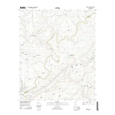
2014 Map of Garden City
USGS Topo · Published 2014About this map
Garden City sits at the southern edge of the Cullman County line, where the winding Mulberry Fork carves a deep path through the landscape. The river's serpentine course creates dramatic landforms like The Narrows, Georgia Bend, and Pumphouse Bend, shaping the local geography and historical settlement patterns. This area is defined by its transition from the plateau into the Blountsville Valley, featuring a network of ridges such as North Ridge and South Ridge alongside isolated peaks like Moore Mtn and Sky Ball Mtn.
Find a feature on this map
153 named features on this map. Tap any name to fly to it.
Don’t see what you’re looking for? This feature index may not catch every label — zoom into the map to look around manually.
Map Details
Editions of this 2014 Garden City Map
This is the sole edition of this map. No revisions or reprints were ever made.
Other maps of this area

1888 · Cullman
USGS Topo · 1:125,000

1889 · Birmingham
USGS Topo · 1:125,000

1892 · Cullman
USGS Topo · 1:125,000

1892 · Birmingham
USGS Topo · 1:125,000

1895 · Birmingham
USGS Topo · 1:125,000

1907 · Birmingham
USGS Topo · 1:125,000

1936 · Holly Pond
USGS Topo · 1:24,000

1951 · Blount Springs
USGS Topo · 1:24,000

1953 · Birmingham
USGS Topo · 1:250,000

1956 · Birmingham
USGS Topo · 1:250,000