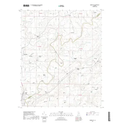
2018 Map of Garden City
USGS Topo · Published 2018About this map
The Mulberry Fork winds through a landscape of sharp bends and ridges along the Cullman Co and Blount Co line, defining the geographic character of this region. Near the western edge, the CSX Transportation corridor serves the established communities of Garden City, Steppville, and Hanceville, where the terrain transitions from the river valley to upland plateaus. This 2018 survey reveals a patchwork of small settlements and family landmarks, including several rural burial grounds such as Bethlehem East Cem and Mount Zion Cem. The presence of Chamblees Mill on the upper reaches of the fork suggests the enduring legacy of early water-powered industry. Topographical features like The Narrows and Pumphouse Bend illustrate the dramatic river hydrology that has shaped local transportation and settlement patterns for generations.
Find a feature on this map
158 named features on this map. Tap any name to fly to it.
Don’t see what you’re looking for? This feature index may not catch every label — zoom into the map to look around manually.
Map Details
Editions of this 2018 Garden City Map
This is the sole edition of this map. No revisions or reprints were ever made.
Other maps of this area

1888 · Cullman
USGS Topo · 1:125,000

1889 · Birmingham
USGS Topo · 1:125,000

1892 · Cullman
USGS Topo · 1:125,000

1892 · Birmingham
USGS Topo · 1:125,000

1895 · Birmingham
USGS Topo · 1:125,000

1907 · Birmingham
USGS Topo · 1:125,000

1936 · Holly Pond
USGS Topo · 1:24,000

1951 · Blount Springs
USGS Topo · 1:24,000

1953 · Birmingham
USGS Topo · 1:250,000

1956 · Birmingham
USGS Topo · 1:250,000