1896 Map of Garden City
USGS Topo · Published 1949About this map
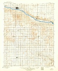
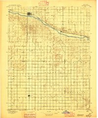
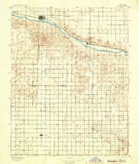
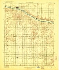
The Arkansas River serves as the central artery for this late-19th-century landscape, carving a path through Southwest Kansas where the Atchison Topeka and Santa Fe R. R. (Main Line) dictates the flow of settlement. The bustling rail hub of Garden City stands as the primary center of commerce, while smaller trackside villages like Sherlock and Pierceville facilitate the region's agricultural transport. South of the river, the township grid stretches across open territory, revealing isolated outposts such as Plymell and the settlement of Ivanhoe.
Find a feature on this map
29 named features on this map. Tap any name to fly to it.
Don’t see what you’re looking for? This feature index may not catch every label — zoom into the map to look around manually.
Map Details
Editions of this 1896 Garden City Map
4 editions found
Historical Maps of Garden City Through Time
1 maps found